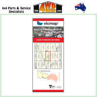
Bacchus Marsh South Topographical Map 1:25 000
Topographical Maps are used for Walking, 4WD, Fishing, Camping, Motorcycle, both On and Off Road, Gold Prospecting and for those simply going for a family weekend drive.
Though moving into an age of GPS & digital maps, paper maps provide a great back up & being more accessible for a group to plot a day out on the tracks.
This is a new series of 1-25,000 scale maps, all of Victoria is now covered by these maps, including maps over the South Australian and NSW Borders.
Topographical maps show not only Contours of the Terrain but Walking Tracks, Sealed and Unsealed Roads, Rivers, Creeks, Lakes, Historical Points of Interest, Old Mine Sites and National and State Park areas.
Map Features:
Cover the old series 1-25,000 maps Ingliston and Lerderderg
Bacchus Marsh, Merrimu, Glenmore, Part of Brisbane Ranges NP, Part of the great Dividing Range, Pentland Hills, Darley, part of Lerderderg SP, Goodman Creek, Merrimu Reservoir, Merrimu Track, Parwan Creek, Mount Darriwill, mbtg, Lake Dewar Lodge YMCA, Korjamnunnip Creek, Long Forest FFR, Sunnystones Country Retreat, Lerderderg River, The Island Lookout, Werribee Gorge SP, Parwan Falls, mbtg, Ingliston Gorge, Ingliston Track, Upper Sloss Gully Cascades, Ironbark Gorge Track, Western Bluff Lookout, Gorrocburkghap Falls, Blackwood Pool, Falcons Lookout, mbtg, Hopetoun Park, Pyrites Creek, Anthonys Cutting, Pyrites, Gorrock, Yaloak Vale, Melton Reservoir, Rowsley, Spring Creek.
Please Note: These maps are provided as a guide only. You are responsible for being aware of track closures, changes to track accessibility & access guides. Please visit the Parks Victoria website to check before planning your next journey.
(7722-1-S)
| SKU | 7722-1-S |
| Barcode # | 9781742088884 |
| Brand | Vicmap |
| Shipping Weight | 0.1000kg |


 More info


