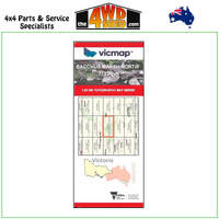
Cann River Orbost Delegate Adventure Map 1:100 000
East Gippsland to Southern New South Wales Second Edition
Topographical Maps are used for Walking, 4WD, Fishing, Camping, Motorcycle, both On and Off Road, Gold Prospecting and for those simply going for a family weekend drive.
Though moving into an age of GPS & digital maps, paper maps provide a great back up & being more accessible for a group to plot a day out on the tracks.
Coverage extends from Orbost and McKillops Bridge to Cann Valley Highway and Tamboon Inlet. An inset map on the reverse side covers the coastal access from Cape Conran to Wingan Inlet including Point Hicks, Sydenham Inlet (Bemm River) and Tamboon Inlet.
Inland the map includes Delegate, Bonang, Bendoc, Goongerah, Combienbar, Cabbage Tree Creek, Bellbird Creek, Glen Arte, Murrungowar, Errinundra National Park, Club Terrace, Tubbut, Deddick etc.
Inset maps on the reverse side include:Sydenham Inlet Access Map; Tamboon Inlet Access Map; Huts & Waterfalls - Far East Gippsland; Cape Conran Coastal park & Camping Area; Attractions Around Bendoc; Neville Falls - Princes Hwy Map; Suggan Buggan - Willis Map; Coastal Access Map: Cape Conran - Wingan Inlet.
Scale of main map is 1:100,000.
Roads and tracks have been carefully field-checked in 2007 / 2008 using GPS technology.
- Scale: 1:100 000 map
- Printed both sides
- Suitable for use with GPS
- Extensive 4wd tracks coverage
- Ideal for camping, touring, motorbiking, 4WD & boating
- Walking tracks and campsites
- Colour with contours & notes
Please Note: These maps are provided as a guide only. You are responsible for being aware of track closures, changes to track accessibility & access guides. Please visit the Parks Victoria website to check before planning your next journey.
ISN : 9781921886256
(9781921886256)
| SKU | 9781921886256 |
| Brand | Rooftops |
| Shipping Weight | 0.1000kg |


 More info


